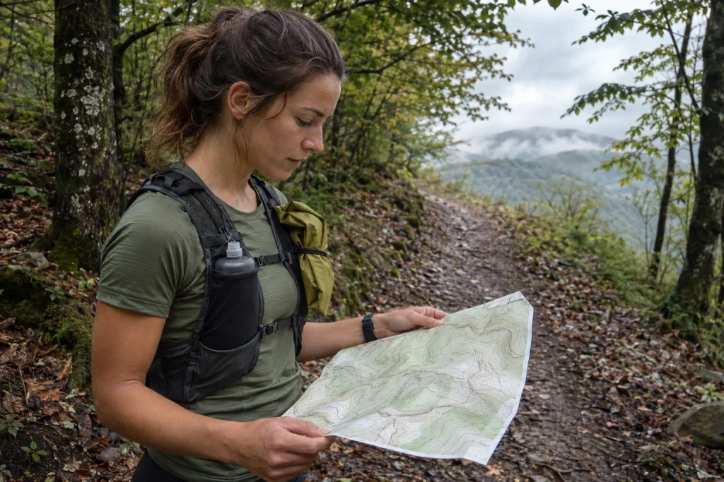
Planning a trail loop truly begins when you add a question beside the line on the map: in what conditions can I complete this, and what will I do if they change? Distance alone cannot answer. Climbs, ground, narrow paths, daylight and transport together shape the task. The same loop in dry daylight and on a muddy, foggy afternoon can be a very different outing.
A good route plan does not guarantee problem-free running in every situation. It provides usable decision points. You know where to turn back, how much flexibility remains, what information you checked and whom to tell about changes. Simplicity is particularly valuable on early trail outings: familiar terrain, a shorter loop and a clear return may matter more than an impressive track that is hard to alter.
Distance, elevation and technicality define the task together
Two twelve-kilometre routes can differ greatly. One follows a broad forestry road with little climbing; another includes roots, rocks and narrow descents. Do not convert your average pace directly from a single road run. Personal experience in similar conditions provides a useful basis for estimating trail time. Without it yet, keep the uncertainty visible.
Alongside elevation gain, examine how it is distributed. One long climb at the start differs from continual short ups and downs. A steep descent is not automatically a rest. Ground and attention demands may make it slower than expected. Read the route as successive sections rather than a single total.
The map is not the current location
An older GPX file shows where someone went on one occasion. It does not establish that the path is still open, passable or permitted today. Forestry work, conservation restrictions, events, storm damage and changed ground conditions can override the old track. Before leaving, also look for official notices from local managers and the area concerned, especially on an unfamiliar loop.
The Duna–Ipoly National Park visitor rules also describe the importance of considerate use of designated paths. A shortcut shown by a navigation app does not authorise leaving them. If the line enters a closed or prohibited section, completing the file at any cost is not the task. Plans can change; on-site rules do not become less important because you have travelled far.
Read the forecast in place and time
Check more than the temperature in the nearest town. Your running window, higher ground, wind-exposed ridges and possible precipitation matter too. Afternoon thunderstorm risk may call for a different decision on a short morning loop than on an all-day route. Do not turn an uncertain forecast into certain good weather merely to reassure yourself.
The HungaroMet severe-weather warning system distinguishes advance warnings from alerts issued as danger approaches. Updating information is therefore part of planning. A screen saved in the morning may no longer show the latest situation later. When interpreting a notice, read both the geographical coverage and the phenomenon concerned.
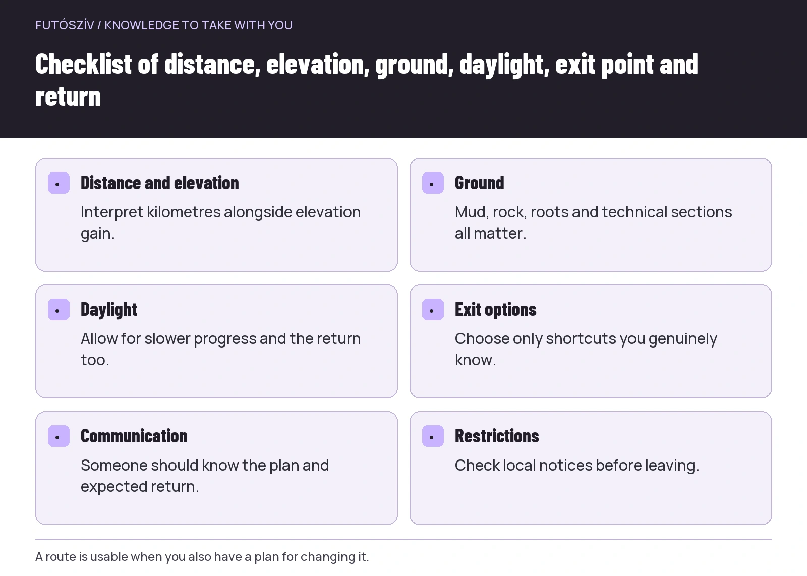 Enlarge diagram
Text version of the illustration
- Distance and elevation
- Interpret kilometres alongside elevation gain.
- Ground
- Mud, rock, roots and technical sections all matter.
- Daylight
- Allow for slower progress and the return too.
- Exit options
- Choose only shortcuts you genuinely know.
- Communication
- Someone should know the plan and expected return.
- Restrictions
- Check local notices before leaving.
A warning is not a point-specific weather prediction
A colour on a map does not say exactly when or what will happen at your bend in the path. Nor does the absence of a warning mean every trail is dry, every branch stable or every section equally usable. The official forecast is one important element, to which you add local conditions and personal experience. In uncertainty, shortening or postponing is a valid choice.
If visibility deteriorates, wind strengthens or the ground is worse than expected, do not rely only on the distance chosen earlier. A new situation requires reassessing the route. This is easier with decision points defined in advance: at which junction to turn, until when the longer option remains feasible and which section to omit under particular conditions.
| Condition | What can it change? | Planning response |
|---|---|---|
| Recent rain and mud | Travel time, grip and trail condition | A shorter route or less vulnerable surface |
| Fog | Navigation and the value of viewpoints | A simpler, familiar loop |
| Strong wind | Whether exposed sections are manageable | Reassess ridges and open ground |
| Shorter daylight | Return and navigation | An earlier start or shorter option |
| A changing forecast | Reliability of the original time window | A fresh check and flexible programme |
| A local closure | Whether the route can be used | An official alternative or another location |
Sunset is more than small print beside the start time
If you want to run only in daylight, work backwards from its full window. At the end, you still need to reach the car, stop or accommodation. After the last woodland kilometre, there may be walking you did not include in the watch route. Leave room in the estimate for slower progress, navigation and a planned stop.
“We will run faster if we are late” is not a good backup. Deteriorating light can require more attention and slower movement instead. If a loop fits daylight only at a perfect pace, choose a shorter route or earlier start. A light alone does not make you ready for an unfamiliar night trail; that requires separate experience too.
Open the navigation at home
Check that the downloaded route actually starts where intended, its direction and whether accidental detours or connecting sections appear. Inspect important junctions at a larger scale too. A thin line filling the screen makes it difficult to understand the valley, settlement or return direction. Landmarks also help when the device screen is hard to read.
If planning to use an offline map, test that the required area is visible without a network. The file and map layer are not the same on every device. Battery, brightness and access are part of the trial too. Do not discover at the first junction that the phone draws its background only online, or the watch route is not on the screen where you expect it.
Have a genuine way to shorten the route
A straight line drawn on the map is not an exit. Choose a return option whose passability and direction you understand. An unfamiliar steep cut-through can create a worse situation than the original route. A figure-of-eight, a loop returning to a central point or a section where you can simply turn back on the same known path can help.
A shortening plan may include transport. If finishing in another settlement, check how to return to the starting point. An infrequent bus or the last train is not a theoretical detail. Recheck timetables shortly before travel, and avoid connections requiring exact adherence on trails to a time that was only an estimate.
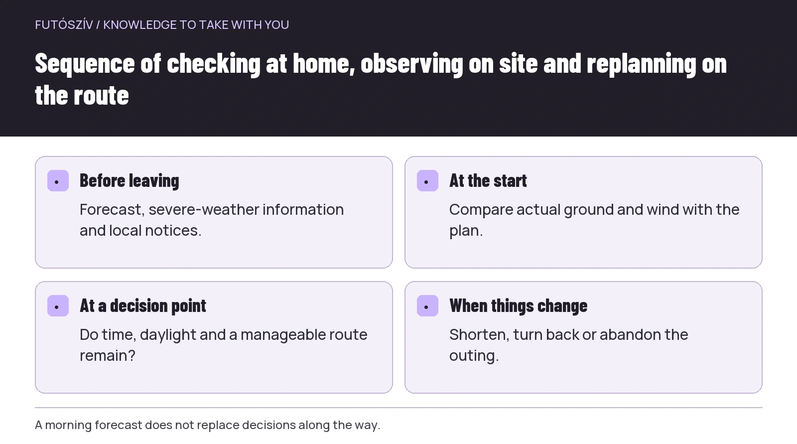 Enlarge diagram
Text version of the illustration
- Before leaving
- Forecast, severe-weather information and local notices.
- At the start
- Compare actual ground and wind with the plan.
- At a decision point
- Do time, daylight and a manageable route remain?
- When things change
- Shorten, turn back or abandon the outing.
A trail plan that fits on one page
| Field | What to include | Example wording |
|---|---|---|
| Starting point | Exact meeting place and approach | The exit of the marked car park, not simply the village |
| Main route | Main direction, markers and important junctions | Along the valley path to the second marked junction |
| Distance and elevation | Estimated figures and their source | Map-planner data, without a personal inspection |
| Time allowance | Expected activity and return | Walking to the stop is included too |
| Option A | A shorter, known route | Back along the same path from the first decision point |
| Decision point | When will you reassess? | Check weather and time before the ridge |
| Communication | Who knows the plan? | A named contact with the starting point saved |
| Closures | What did you check and when? | The land manager’s current notice on departure morning |
Everyone in a group needs to know the plan
A line on one person’s phone is insufficient. Before leaving, describe the loop, stopping points and shorter options. Clarify whether you stay together, regroup at junctions and who watches the back. With mixed experience, even the least certain participant needs an understandable programme rather than nicknames meaningful only to regulars.
An early departure should not be a silent disappearance. Agree whom someone tells when turning back or continuing separately. Also confirm a successful return to the person at home who knew the route. A communication plan is complete only when it is closed. A missing message can create unnecessary worry even when everything is fine.
Three situations in which a shorter loop is the better plan
The ground is muddier than expected. Progress is slower on the first climb and descending also demands more attention. Choose the known shortcut instead of the longer planned loop. The decision is not about losing distance; it adapts the outing to actual conditions. The other option remains for a dry day, while today’s run stays manageable.
The start was delayed. Transport or late arrivals have reduced daylight. The original loop need not automatically retain the same expectations. A shorter route preserves a calm return and travel buffer. If the programme’s only meaning is its chosen kilometre total, clinging to a poor decision becomes easier; if a shared trail experience is the goal, flexibility remains.
The weather situation changes. Before an exposed section that looked manageable at the start, new information arrives or local conditions worsen. The decision point was in the plan so you could actually use it. Do not wait until turning back is difficult too. Letting go of the original destination can be the most accurate execution of the backup plan.
Nature is not a backdrop for running
The Bükk National Park guidance also notes that leaving designated routes can complicate assistance. Following marked paths is therefore both navigation and care for nature. Do not cut corners, widen muddy trails through vegetation or leave fuelling packaging behind.
At the end, briefly review the plan’s accuracy. Where did progress take longer, which marker was hard to spot and did the exit option work? This is personal trail experience to use next time. Good route planning becomes continuous learning: after every loop, more real knowledge informs the next decision rather than simply drawing a longer line on the map.
How Futószív articles are prepared: our editorial guidelines.